DESCRIPCIÓN DEL SISTEMA
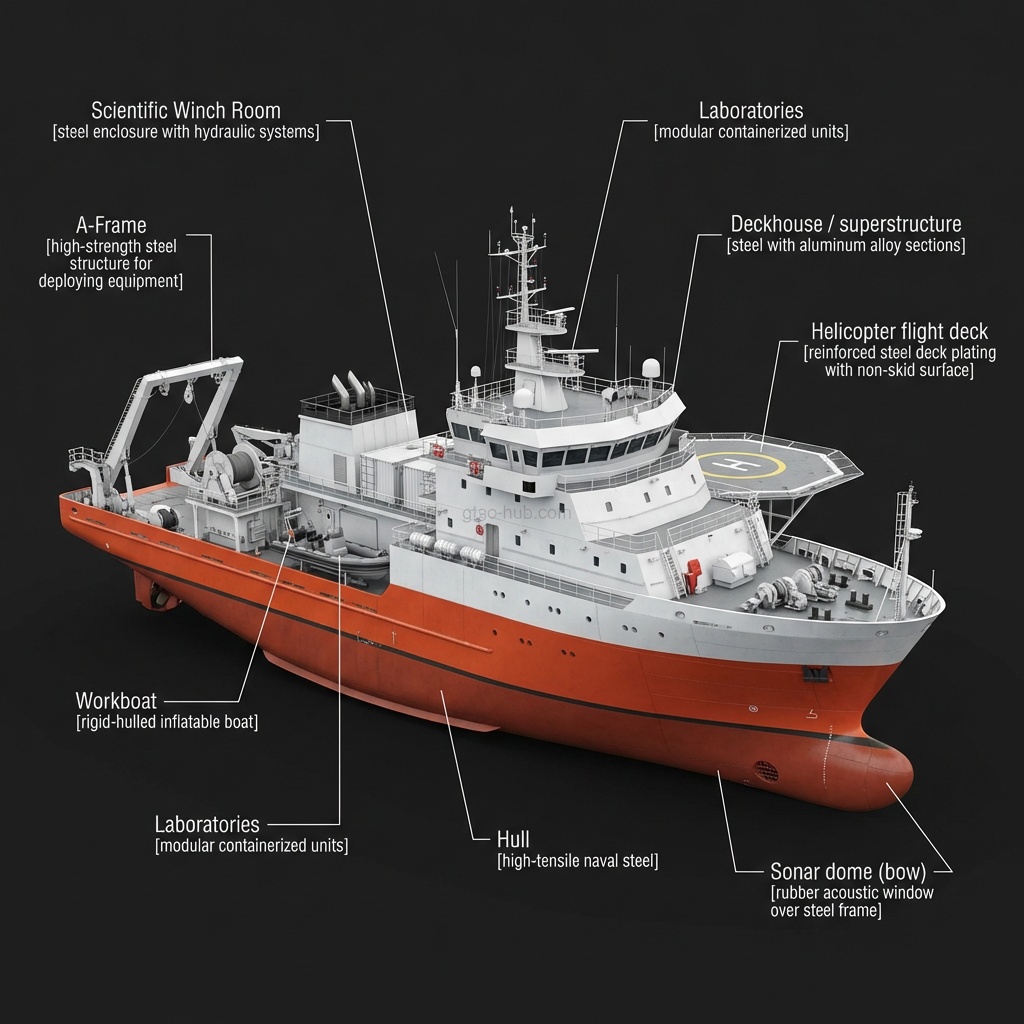
Buque de investigación oceanográfica e hidrográfica de la Armada Turca. Realiza mapeo del fondo marino, monitoreo ambiental y encuestas oceanográficas en apoyo de operaciones navales e investigación científica.
OPERADORES (1)
Türkiye
2ACTIVO
FABRICANTE
Various
VER TAMAÑO COMPLETO
TCG Derya - Various
VENTAJAS
- Turkish Aegean/Black Sea bathymetric mapping
- Submarine route survey support
- Weather/oceanographic data for operations
DESVENTAJAS
- Unarmed research vessel
- 16-knot limited
- High-value low-priority target in conflict
ESPECIFICACIONES TÉCNICAS
CREW55
MISSIONOceanographic Research, Hydrographic Survey
LENGTH M85
SPEED KNOTS16
DISPLACEMENT TONNES1750
Discussion & Reviews(1)
Sign in to join the discussion and rate this weapon system
SIGN INSISTEMAS SIMILARES
IFF and deconfliction protocols are where the operational complexity of this system will manifest in real deployments.